This eight-mile stretch of New Mexico highway hides trout streams and towering rock walls: Here’s what to know
Shutterstock
It’s on the Enchanted Circle Byway
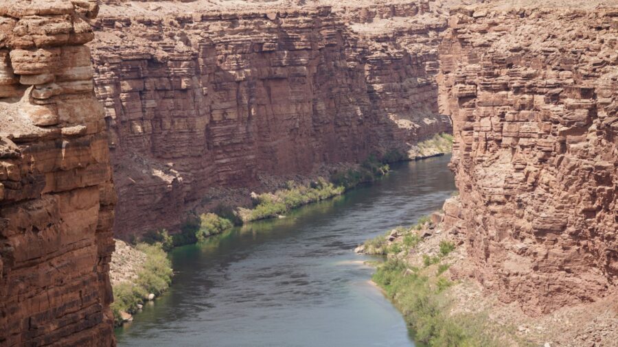
Cimarron Canyon State Park sits about three miles east of Eagle Nest in northern New Mexico, tucked into a narrow mountain canyon at close to 7,900 feet. The Cimarron River carved this place over millions of years, and thick stands of pine, fir and cottonwood crowd both sides of the water. The canyon stretches roughly eight miles along the Enchanted Circle Scenic Byway, a well-loved mountain loop. Most people drive right through it. The ones who stop find something worth a lot more than a windshield view. Wikimedia Commons/Highlightwiki
Pale stone pillars from 40 million years ago
The Palisades Sill is the first thing you notice. A wall of tall, pale, column-shaped cliffs rises above the canyon, and the New Mexico Bureau of Geology calls it one of the most spectacular geologic features in the northern part of the state. The rock formed underground roughly 40 million years ago, as the Southern Rocky Mountains pushed up. It cooled and cracked into tall, thin columns, so the whole formation looks like a row of pillars. The canyon walls around it expose rock layers that span almost two billion years of Earth’s history. Wikimedia Commons/Billy Hathorn
You can see the cliffs without leaving your car
Those columns climb 300 to 400 feet straight up from the canyon floor, and they rise right beside the highway. You don’t need a long hike to stand beneath them. A signed pullout and day-use area sits at the base, so you can park and look straight up at pale rock set against green forest and blue sky. Broken columns pile at the bottom where pieces have fallen over time. Bring a camera. This is the photo spot. Shutterstock
Wild brown trout hold in cold, fast water
The Cimarron River runs the length of the canyon, and the state park agency calls it one of New Mexico’s premier trout fishing spots. Wild brown trout hold in the current, and the state stocks rainbow trout through the season. Two clear tributaries, Clear Creek and Tolby Creek, give you even more water to work. The shallow, fast runs and summer insect hatches pull fly fishers from across the state. Small gravel-pit ponds in the park hold stocked trout too, if you want an easier cast. Shutterstock
Follow Clear Creek past waterfalls and board bridges
The Clear Creek Trail starts near milepost 292, and it’s the most popular hike in the park for good reason. You follow the creek upstream past several small waterfalls, with the sound of rushing water the whole way.
The path runs gentle and shaded, close beside the creek, and simple board bridges carry you across the stream in a few spots. Past the last waterfall, the trail turns steeper and rockier, climbing to a viewpoint where the canyon opens up below you. Shutterstock
Trails head into the hills on horseback or on foot
Clear Creek is just the start. The park connects to several trails in the Colin Neblett Wildlife Management Area, and the terrain spreads out fast. The Tolby Creek Trail heads south up its own creek drainage. The Maverick Trail leads north into the hills above the canyon. Both wind through pine forest with views of the river and cliffs below. Some trails allow horses, so riders can cover miles of mountain country without seeing pavement. Shutterstock
Cool air and dark skies at 7,900 feet
While lower New Mexico bakes in summer, this canyon stays cool. The high elevation, year-round flowing water and deep shade make it a natural escape from the heat. Clean air and bright sunshine fill the days, and at night the sky goes dark enough to see the Milky Way without trying. The forested canyon feels remote and quiet, a place where you can sit by the river and hear nothing but water and wind, even though the road runs right through it. Shutterstock
Fall asleep to the sound of the Cimarron River
Four campground areas spread through the park: Blackjack, Maverick, Tolby and Ponderosa. Many of the sites sit right along the Cimarron River or the creek, shaded by tall trees. You get picnic tables, fire pits and restrooms, all in a rustic setup. Tolby Campground, on the west side, is home to the park’s visitor center. The sites are simple and wooded, and at night the sound of running water comes through the trees and stays with you until morning. Shutterstock
Elk, bear and beaver share the canyon
The park sits at the heart of the Colin Neblett Wildlife Management Area, the largest in New Mexico. Elk, mule deer and black bear all move through the canyon and the surrounding forest. Wild turkey and grouse show up among the trees. Beaver work the river, building ponds along the water. Early morning and evening are the best times to spot animals near the riverbanks, so set your alarm or stay out past dinner if you want a look. Shutterstock
Golden eagles soar above the ridgeline
Birdwatchers at any level will find something here.
Read more from this brand:
This southern New Mexico park has wild goats, black skies, and rocks you get to keep
New Mexico’s 35-million-year-old volcanic rock city looks like another planet
This lakeside Minnesota town is quietly outclassing every coastal village in New England
The post This eight-mile stretch of New Mexico highway hides trout streams and towering rock walls appeared first on When In Your State.
Hummingbirds visit the wildflowers and forest edges in warmer months, darting between blooms along the trail. Golden eagles ride the thermals above the cliffs and ridgelines, and you can watch them circle without binoculars. Songbirds fill the pines, and wild turkeys move through the underbrush. Different trails and habitats pack a wide mix of species into one small stretch of canyon, so bring your field guide. Wikimedia Commons/Alexander Hatley
Wade into the river with a sandwich and no agenda
Developed day-use areas along the river give you picnic tables and grills under the pines. Pullouts line the highway, so you can park almost anywhere and walk to the water. The riverbanks run gentle enough for families to wade in and cool off without worry. You don’t need a trail map or a fishing rod to enjoy this place. Sometimes the best thing to do in Cimarron Canyon is find a shady spot, eat lunch and listen to the river roll past the rocks. Shutterstock
The drive alone is worth the trip in October
For many visitors, the road through the canyon is the main draw. The highway runs right beside the river and crosses it several times, threading between the towering Palisades and forested slopes. In autumn, aspens and cottonwoods turn gold against the dark evergreens, and the whole canyon lights up. The scenic byway connects to nearby mountain towns and lakes on both ends. Even if you never leave the car, eight miles of this road will change how you think about New Mexico. Shutterstock
Fish, hike and camp at Cimarron Canyon State Park
You can find Cimarron Canyon State Park about three miles east of Eagle Nest on U.S. Highway 64, along the Enchanted Circle Scenic Byway. Day-use fees vary by residency and season. To park at a trailhead, you need a park permit, a hunting or fishing license, or a New Mexico Department of Game and Fish access permit. Fishing requires a state license, and one stretch below Tolby Campground is catch-and-release only with a single barbless fly or lure. Rock climbing is not allowed anywhere in the park, including the Palisades. Check the official New Mexico State Parks page for current conditions before you go. This article was created with AI assistance and human editing. Read more from this brand:
This southern New Mexico park has wild goats, black skies, and rocks you get to keep
New Mexico’s 35-million-year-old volcanic rock city looks like another planet
This lakeside Minnesota town is quietly outclassing every coastal village in New England
The post This eight-mile stretch of New Mexico highway hides trout streams and towering rock walls appeared first on When In Your State.
Leave a Reply