New Mexico blasted these rock tunnels for trains a century ago; now you can just drive through: What we know so far
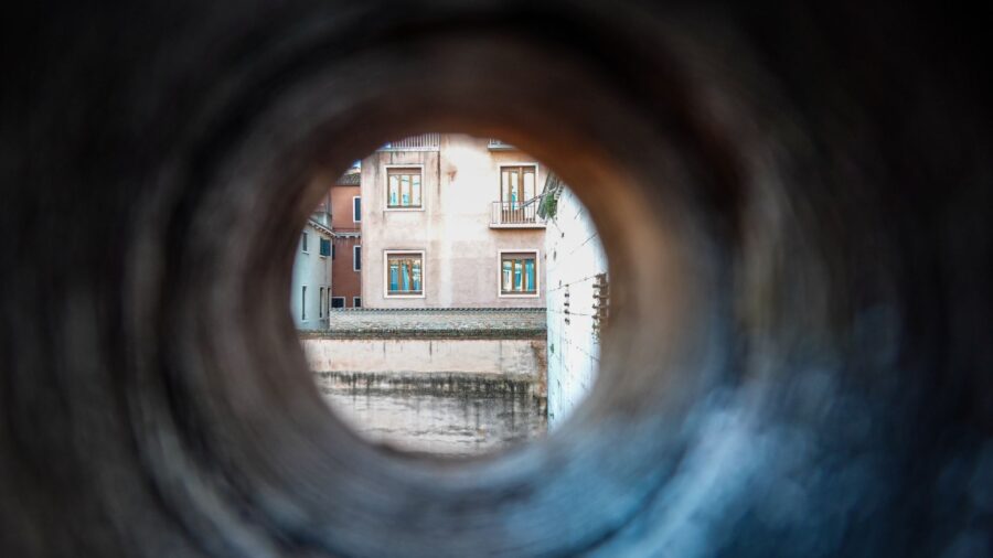
Shutterstock
The Gilman Tunnels hide in the Jemez Mountains
Two tunnels sit in a narrow New Mexico canyon, cut straight through rock that’s been standing for more than a billion years. The Rio Guadalupe races through the canyon below them. The walls press in close. Workers blasted these openings in the 1920s so logging trains could get through, and a century later, the same path carries cars. Most people drive right past the turnoff without knowing what’s back there. Flickr/jaygannett
A railroad that hauled lumber out of the mountains
The Santa Fe Northwestern Railway put the tunnels here, and the job was to get timber down from the Jemez Mountains as fast as possible. Workers blasted two openings through solid canyon rock in the 1920s. The railroad took the name of William H. Gilman, an executive tied to the line. Then in 1941, a flood tore out the tracks, and the railroad was done. The Forest Service paved over the old rail bed, and that’s the road you drive today. Wikimedia Commons/John Fowler
One car at a time through the Guadalupe Box
The road narrows when you reach the tunnels. Rock walls close in from both sides, and you go through one vehicle at a time. The paving is tight with sharp curves you can’t see around, so you take it slow. This stretch, called the Guadalupe Box, marks where the canyon squeezes to its thinnest point. Traffic is usually light out here, which means you can pull over, step out, and stand at the edge of something that took over a billion years to form. Flickr/snowpeak
A waterfall waits just past the second tunnel
Clear the second tunnel and the river drops. The Rio Guadalupe spills over into a waterfall right there off the road, no long walk needed. In spring, the water is loud and fast, and you feel it in your chest. The rocks around the falls give you places to climb and sit. The nearby village of Jemez Springs claims three waterfalls in its backyard, and this is one of them, right at the mouth of the canyon where the road widens back out. Shutterstock
Rock walls that go back 1.4 billion years
The tunnels cut through some of the oldest exposed rock in New Mexico. A crack in the earth called the Jemez fault pushed this ancient stone up from deep underground, which is why you can see it at eye level now. Clear bands of rock layers stack up the canyon walls as you drive through.
The Jemez Mountains press against the Sierra Nacimiento out here, and the canyon sits right where those two ranges meet. The geology is written right there on the walls if you know what you’re looking at. Shutterstock
A volcano shaped this whole canyon
The Jemez Mountains sit on top of millions of years of volcanic activity. A massive eruption here left a giant bowl in the earth. Over time, the Rio Guadalupe cut down through the volcanic rock and carved the deep, narrow canyon you’re now driving through. Pale volcanic cliffs rise in the distance beyond the box canyon. The canyon walls run red and orange depending on the light, and photographers come out in all seasons to work with those colors. Wikimedia Commons/NMMIMAJ
Jemez Falls drops 70 feet through the pines
A short drive from the tunnels, Jemez Falls is the tallest waterfall in the Jemez Mountains. It drops about 70 feet along the East Fork of the Jemez River, deep inside ponderosa pine forest. A short trail runs from a nearby campground to an overlook where you get the whole falls in front of you, top to bottom. The trail is easy enough for kids, and the overlook puts you at eye level with the drop. It pairs well with the tunnels as a morning stop. Shutterstock
Battleship Rock juts out 200 feet above two rivers
Volcanic activity about 74,000 years ago built Battleship Rock, a stone formation that rises around 200 feet and angles out from the mountainside like the bow of a ship. Two rivers come together at the base. There’s a picnic area right below it, and people come to sit by the water and eat lunch in the shadow of that wall of rock. You can see the formation clearly from the road. Pull over and look up, and the scale of it takes a second to register. Shutterstock
Soda Dam built itself one mineral drip at a time
Soda Dam stretches across the Jemez River like a lumpy wall that doesn’t belong there, and that’s basically what it is. Mineral springs have been depositing material here for thousands of years, building up a natural dam across the river. Water pushes through a gap and falls into a pool below. The rock at this spot dates back among the oldest in the whole Jemez Valley. You can see it from the road, or you can stop and walk right up to the edge where the water pours through. Shutterstock
Hot springs tucked into the forest, free to visit
The forest around the tunnels holds natural hot and warm springs in the trees. Spence Hot Springs sits at the end of a short hike and has a small pool set into a tiny cave.
Read more from this brand:
Sierra County’s 154-mile loop hides ghost towns, hot springs, and almost no traffic
Deep in the Gila National Forest, a walkway clings to the cliffs above a slot canyon
New Mexico’s Turquoise Trail swaps I-25 for ghost towns and a 10,000-foot mountain
The post New Mexico blasted these rock tunnels for trains a century ago; now you can just drive through appeared first on When In Your State.
McCauley Warm Springs sits farther out along a trail near Battleship Rock. Both pools stay warm year-round, fed by heat underground. They’re on public land, open during daylight hours, and free. On a cool morning in October, the water temperature and the cold air hit at the same time, and that contrast is most of the appeal. Shutterstock
Trails, wildlife and cliffs in the Santa Fe National Forest
The Santa Fe National Forest wraps around all of this, and the outdoor access that comes with it is wide open. At least 10 hiking trails run through the area, from flat easy walks to full climbs with serious elevation. The canyon walls pull in rock climbers. The rivers run with trout. Deer and elk move through these mountains, and the birdwatching is steady year-round. You can hike, fish, camp and come back the next day and do it again on a completely different trail. Wikimedia Commons/Daniel Schwen
The tunnels outlasted the railroad that built them
A small town called Gilman once stood near these tunnels. Almost nothing remains of it. The railroad that built the tunnels shut down in 1941 after a flood destroyed the tracks, and the logging era that drove all of it faded with it. What’s left are two openings blasted through billion-year-old rock, a paved road running over the old rail bed, and a canyon that operated long before any of it arrived. The Forest Service took over the tunnels and kept them open, which means you can still drive through them today the same way the trains once did. Wikimedia Commons/Skarz
Visit the Gilman Tunnels in Jemez Springs, New Mexico
To get there, take State Highway 485 off NM 4 near Jemez Springs. The tunnels and the canyon road are free to visit, with small pullouts near the tunnel entrances where you can park and step out. The road is paved but narrow with blind curves, so go slow. The unpaved forest road beyond the tunnels often closes in winter when snow comes in. Plan a full day and pair the tunnels with Jemez Falls, Battleship Rock, Soda Dam and the hot springs, all within a short drive of each other. This article was created with AI assistance and human editing. Read more from this brand:
Sierra County’s 154-mile loop hides ghost towns, hot springs, and almost no traffic
Deep in the Gila National Forest, a walkway clings to the cliffs above a slot canyon
New Mexico’s Turquoise Trail swaps I-25 for ghost towns and a 10,000-foot mountain
The post New Mexico blasted these rock tunnels for trains a century ago; now you can just drive through appeared first on When In Your State.
Leave a Reply