One flat Oregon trail, one spring-fed waterfall, zero crowds at Crater Lake: Officials say
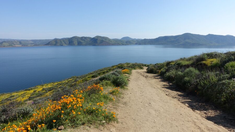
Shutterstock
It’s the park’s quietest mile
You come to Crater Lake for that deep blue water, and so does everybody else. But on the east side of the park, a short trail cuts through old-growth forest to a 20-foot waterfall that most people drive right past. The walk takes about an hour. The path is mostly flat. And at the end, spring-fed water drops over a mossy cliff into a green pocket of ferns and wildflowers. The crowds stay up on the rim. This spot belongs to the people who know about it. Wikimedia Commons/Gary Halvorson, Oregon State Archives
“Plaikni” means “from the high country” in Klamath
The Klamath people lived on these lands for generations, and the name they gave this place tells you where the water comes from. Springs high on the slopes of the old volcano feed the falls, and the water flows down Sand Creek before it tumbles over a cliff that glaciers carved thousands of years ago. The park didn’t open this trail until 2011, so it’s one of the newer paths in the system. The name stuck because it fit. Wikimedia Commons/Bobjgalindo
Two miles round trip with barely any climbing
The whole walk runs about two miles out and back, and most of it stays flat. A gentle rise near the end is the only real climb, though that last short stretch can get steep enough to stop a wheelchair. Everything before it is accessible. Families with small kids do this trail without any trouble, and you can finish the loop in about an hour. Or you can take your time on the benches along the way and stretch it longer. Wikimedia Commons/Bobjgalindo
Tall fir and hemlock shade the whole path
From the trailhead, you walk under a canopy of old-growth fir and hemlock that blocks most of the sun. On a warm day, the shade drops the temperature enough that you’ll notice. The path runs wide and smooth, and the park keeps it in good shape. Rocky cliffs rise in the distance as you go, and every few minutes a bench appears along the trail. You don’t rush this walk. The forest sets the pace. Wikimedia Commons/Bobjgalindo
Monkeyflower, columbine and paintbrush line the meadows
Come in summer and the meadows along the trail fill with color.
Red, yellow and purple blooms crowd the ground near the water, and you’ll spot monkeyflower, columbine and paintbrush if you look close. Butterflies work the spray near the falls on warm days, drifting between the wet rocks and the flowers. Bring bug spray, though. Mosquitoes live near the creek, and they find you fast once you stop moving. Shutterstock
Listen for pikas calling from the rocks
Pikas are small, round, furry animals that live in the rock piles along the trail, and you’ll hear their sharp calls before you see them. Marmots sun themselves on the bluffs when the weather is warm. Songbirds fill the trees overhead, and red-tailed hawks ride the thermals above the canyon. Stay on the trail through here. The plants near the stream are fragile, and your boots can do more damage than you’d think. Wikimedia Commons/Bobjgalindo
Spring water drops over a mossy, glacier-carved cliff
At the end of the trail, you stand at the base of the falls. Water slides over a cliff covered in thick green moss, and ground cover creeps right up to the edge of the pool. The whole scene stays green and lush even late into summer because the springs don’t dry up. For a 20-foot waterfall at the end of a one-mile walk, it delivers more than you expect. The sound alone is worth the trip. Shutterstock
Pinnacles Road gets you there from the east side
The trailhead sits along Pinnacles Road, a spur off the East Rim Drive on the park’s east side. A small parking lot marks the start. The trail opens in early July most years and stays accessible into October, depending on snow. Here’s the catch for 2026: road construction on the east rim is changing how you reach this part of the park. Check current conditions before you drive out, or you could hit a dead end. Shutterstock
A rock island shaped like a ghost ship floats below
Near the Pinnacles Road turnoff, the Phantom Ship Overlook gives you a view of a rock island that looks like a sailing ship rising from the water. The rock is some of the oldest in the park. You can pull over and take it in without leaving the road, and it pairs well with a Plaikni Falls visit when the route is open. Two stops, one road, and neither one draws the crowds that the west rim pulls.
Read more from this brand:
Oregon’s deepest lake sits inside a volcano and you can see 100 feet straight down
The Black Hills state park with bison jams, wild burros, and house-sized boulders
The deepest lake in America is open in 2026 and southern Oregon wants you to know it
The post One flat Oregon trail, one spring-fed waterfall, zero crowds at Crater Lake appeared first on When In Your State.
Wikimedia Commons/Gregory "Slobirdr" Smith
Hardened ash spires rise from a canyon like chimneys
Keep driving Pinnacles Road past the falls trailhead and you hit another strange sight. Tall, thin spires of volcanic ash stand in a canyon, formed when gas escaped through the rock long after the eruption. A short trail runs along the canyon rim, and you can walk it in minutes. This is one of the quieter corners of the park, and most people never make it out here. The spires look like something from another planet. Wikimedia Commons/Art Anderson
Sunlight sinks deep before it fades to blue
Crater Lake gets its color from depth and clarity. The water is so clear that sunlight travels far down before it scatters, and what bounces back is that deep, saturated blue you see in every photo. It’s one of the clearest large lakes in the world. Overlooks along the rim put you right above it, and the color shifts through the day as the light changes. Morning and late afternoon hit different, and both are worth seeing. Shutterstock
A collapsed volcano holds America’s deepest lake
Crater Lake sits in the bowl left behind when Mount Mazama collapsed roughly 7,700 years ago. The eruption blew the top off the mountain, and rain and snowmelt filled what remained. At its deepest point, the lake reaches about 1,943 feet, making it the deepest in the United States. No rivers feed it and none drain it. What you see is thousands of years of rain and snow, held in a volcanic crater with nowhere to go. Shutterstock
Hit the trail at Plaikni Falls in Oregon
If you want to see Plaikni Falls for yourself, head to the east side of Crater Lake National Park. The trailhead sits off Pinnacles Road, and the two-mile round trip walk takes about an hour. The trail typically opens in early July and stays open into October. In 2026, East Rim Road work may affect access, so check the park’s current conditions page before you go. Bring water, sturdy shoes and bug spray in summer. This article was created with AI assistance and human editing. Read more from this brand:
Oregon’s deepest lake sits inside a volcano and you can see 100 feet straight down
The Black Hills state park with bison jams, wild burros, and house-sized boulders
The deepest lake in America is open in 2026 and southern Oregon wants you to know it
The post One flat Oregon trail, one spring-fed waterfall, zero crowds at Crater Lake appeared first on When In Your State.
Leave a Reply