Pend Oreille: the Idaho lake name you’re saying wrong and the place you’re missing: Authorities confirm
Shutterstock
Lake Pend Oreille’s ice-carved secret
Say it right: pond oh-RAY. That’s the first thing locals will tell you. The second is that this lake is much bigger than you expected. It stretches 43 miles through the Idaho Panhandle with 111 miles of shoreline, three mountain ranges rising from its edges, and water dropping more than 1,150 feet to the bottom. Ice Age glaciers carved all of it. And the history running along its shores goes back centuries before anyone thought to put it on a map. Wikimedia Commons/Dicklyon
From fur trader to the Navy’s biggest training ground
Long before roads reached these shores, the Kalispel and Kootenai peoples fished and gathered along this water. In 1809, explorer David Thompson built Kullyspell House near the town of Hope, the first trading post and the first structure a white man ever put up in Idaho. A century and a half later, the lake’s south end transformed into something else entirely. The Farragut Naval Training Station processed more than 293,000 sailors during World War II, briefly making it the largest “city” in all of Idaho. Shutterstock
Push off from shore and go any direction you want
The lake handles everything you bring to it. Power boats, sailboats, water skiers, and jet skis all spread across the open water in summer. But the quieter corners are worth seeking out too. Near Hope, calm bays around Warren, Cottage, and Pearl islands give kayakers and paddleboarders stretches of water with no wake and no rush. If you don’t have your own boat, rentals are easy to find in both Sandpoint and Hope. Shutterstock
The rainbow trout here once broke a world record
In 1947, someone pulled a 37-pound Kamloops rainbow trout from these waters and set a world record that held for decades. A 32-pound bull trout pulled from the same lake also claimed a record at the time. Those fish didn’t come from nowhere. The lake runs cold and deep, and that combination grows them big. Mackinaw, kokanee salmon, bass, pike, walleye, and perch all swim here too. Landing something over 20 pounds is not as rare as you’d think.
Wikimedia Commons/Tony Webster
Farragut State Park covers 4,000 acres of old naval ground
The park sits at the lake’s southern tip where the Navy once ran its wartime operation. Today those old base roads serve as trails for hikers, mountain bikers, and horseback riders. More than 40 miles of them cut through the park’s 4,000 acres, including the easy Squirrel Cache Trail that works well for families. Beaver Bay Beach is a calm stretch of lake shore good for swimming. The park also has several 18-hole disc golf courses, and 16,000 feet of lakefront runs along its edge. Wikimedia Commons/Sheila Sund
Step inside the building where Navy sailors were confined
The Museum at the Brig occupies the park’s original naval confinement building. Inside, photographs, personal objects, and first-hand accounts bring the training station’s wartime years back to life. The base’s footprint still shapes the park, with old roads now doubling as the same trails hikers walk today. In summer, rangers run guided hikes through the grounds and evening campfire programs that put the history in context. It’s the kind of place where the past isn’t behind glass, it’s under your feet. Shutterstock
Sandpoint’s downtown sits right at the water’s edge
The town of Sandpoint runs along the west shore and makes a practical base for the whole lake. Its downtown fills with historic storefronts, art galleries, and local shops you can cover in an afternoon on foot. The Panida Theater anchors the block, a community-rescued venue from 1985 that still runs films and live performances. Everything sits close together, so you can park once and walk all of it without backtracking. Shutterstock
City Beach packs a lot into 22 acres
A small Statue of Liberty stands at the end of a pier at Sandpoint City Beach, which is the kind of detail that stops you mid-walk. The park stretches 22 acres right beside downtown and has sandy shores, grassy lawn, and calm water that’s good for swimming. You’ll also find volleyball, tennis, basketball, and horseshoes if you want to stay busy. Lake cruises and boat tours leave from this area, so you can get out on the water without renting your own boat. Shutterstock
A bridge full of shops that Europe inspired
The Cedar Street Bridge in Sandpoint started as a simple footbridge over Sand Creek in the late 1800s. A wider span went up in 1906 to move people from downtown to the train depot, and the bridge went through several rebuilds before reopening in the 1980s as a covered public market. The design draws on the shop-lined bridges of Europe, specifically Florence’s Ponte Vecchio.
Read more from this brand:
Idaho Tourism Is Down 11 Months Straight and the State Needs Visitors
You have to earn these Idaho hot springs with a two-mile climb up a canyon
The ice age left a 10,600-acre white sand surprise in eastern Idaho’s farm belt
The post Pend Oreille: the Idaho lake name you’re saying wrong and the place you’re missing appeared first on When In Your State.
It’s often called the only bridge marketplace in the country, and walking through it takes about five minutes if you don’t stop to browse. Shutterstock
The Green Monarch cliffs rise straight from the water
On the east side of the lake near Hope, the Green Monarch cliffs cut up from the shoreline in a sharp rise that you notice from the water before you notice it from land. A ridge trail above those cliffs puts you at a height where the lake and the mountain ranges beyond it spread out in every direction. MacDonald Viewpoint gives you a shorter walk to a good overlook if you don’t want the full trail. Drivers who follow the Pend Oreille Scenic Byway along the north shore get the rocky cliff faces up close from the road. Shutterstock
Osprey, eagles, and bears share these shores
The lake holds one of the highest concentrations of nesting osprey in the region. Bald eagles set up along the shoreline through the warmer months and come back in even greater numbers for winter. The Pack River Delta, where the river fans out before meeting the lake, draws waterfowl and rewards patience. Away from the water, the surrounding forests hold deer, bears, bobcats, and coyotes. You don’t have to go far from the main roads to find yourself in country that feels genuinely wild. Shutterstock
The lake doesn’t close when summer ends
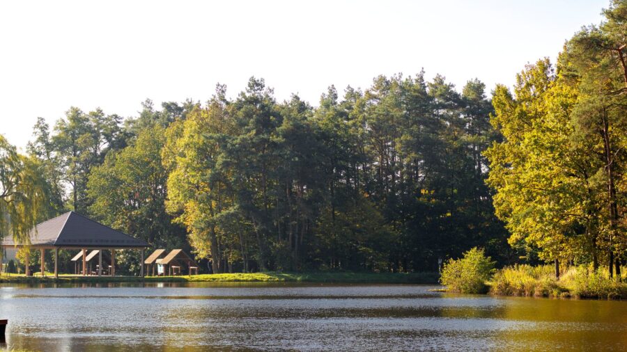
Come in fall and the forests that ring the lake go through a full color change, orange and gold running down to the waterline. Winter brings a different reason to come: bald eagle watching along the shore picks up as the season deepens. Skiers and snowboarders head to nearby Schweitzer Mountain. Spring trails run quiet, and the wildlife that spent winter somewhere else starts moving back in. The lake works year-round, and every season trades something for something else. Shutterstock
Explore Lake Pend Oreille’s shoreline in Idaho
You can reach the lake at Sandpoint in the Idaho Panhandle, about 50 miles northeast of Spokane, Washington. The Pend Oreille Scenic Byway follows Idaho Highway 200 from north of Sandpoint east to the Montana state line, with pullouts along the rocky north shore where you can stop and take in the water and cliffs. Farragut State Park sits at 13550 ID-54 in Athol and opens daily at 9 a.m. Check the official website for current park fees and camping reservations before you go. This article was created with AI assistance and human editing. Read more from this brand:
Idaho Tourism Is Down 11 Months Straight and the State Needs Visitors
You have to earn these Idaho hot springs with a two-mile climb up a canyon
The ice age left a 10,600-acre white sand surprise in eastern Idaho’s farm belt
The post Pend Oreille: the Idaho lake name you’re saying wrong and the place you’re missing appeared first on When In Your State.
Leave a Reply