The Sonoran Desert ends at this Arizona cliff and elk take over from there: Here’s what to know
Shutterstock
Arizona’s best-kept cool escape
Two hours from Phoenix, Arizona folds upward into a 200-mile wall of rock and pine. The Mogollon Rim isn’t a mountain range. It’s an escarpment, a cliff edge where the Colorado Plateau simply stops and the land falls away. You drive north from the Sonoran Desert heat and the temperature drops 20 degrees before you even reach the top. Cold lakes, tall pines, elk in the meadows. And from the edge, the view drops thousands of feet. Most Arizonans know it’s there. Most visitors have never heard of it. Shutterstock
A 200-mile cliff that splits Arizona in two
The Mogollon Rim runs nearly 200 miles across the state, stretching from near Flagstaff toward the New Mexico border. It marks the southern edge of the Colorado Plateau, and where the cliff breaks, the land drops as much as 2,000 feet straight down to the terrain below. The average elevation up top sits around 7,000 feet, pushing to 8,000 in spots. From the air, it looks like someone drew a hard line across the middle of Arizona and said everything north rises and everything south falls. Wikimedia Commons/Hunter Trick
How “muggy-own” got its name
Locals don’t say it the way it looks. Say “muggy-own” and you’ll fit right in. How the name arrived is less settled. One story links it to a Spanish governor of New Mexico in the early 1700s. Another points to mistletoe, a plant that grows across the plateau. The cliff itself took shape over millions of years as erosion and shifting rock slowly carved the escarpment out of the land. The name debate never fully resolved. The cliff did. Shutterstock
Stand at the edge and see for miles
Pullouts along the top of the Rim put you right at the cliff’s brink with nothing between you and thousands of feet of canyon air. Military Sinkhole and Rim Lakes Vista are signed stops where you can step out of the car and look south across pine forest and rolling canyon for what feels like forever. On a clear day, distant mountain ranges pile up along the horizon. The light hits the rock differently at sunrise and sunset, and if you time it right, the whole valley below you changes color. Wikimedia Commons/davidpinter
The pines here smell like butterscotch
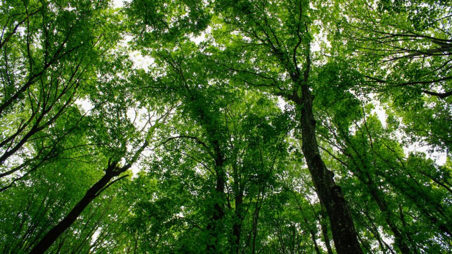
The Mogollon Rim sits inside the largest ponderosa pine forest in the United States. Tall pines run in every direction as far as you can see, with fir, oak and quaking aspen mixed through. Press your hand against the bark of a sun-warmed ponderosa and lean in.
The smell is vanilla, or sometimes butterscotch, a thing that surprises almost everyone the first time. Come in fall and the aspens and oaks turn gold, and the whole forest goes warm and quiet before the snow arrives. Shutterstock
Drive the cliff’s edge on Rim Road
Forest Road 300, called Rim Road, runs about 45 miles along the very top of the escarpment between State Route 260 and State Route 87. Part of it is paved. Part of it is gravel. The road stays close to the cliff edge through thick pine forest, and the lookout points along the way keep opening up into valleys, canyons and faraway peaks. Wildlife crosses the road without much notice of cars. Most drivers stop a lot, and that’s the right way to do it. This is not a road you rush. Shutterstock
Fish a cold lake at 7,500 feet
Woods Canyon Lake sits right on top of the Rim and draws more visitors than any other lake up here. Rainbow and brown trout are stocked regularly, and a lakeside store rents boats and sells supplies. An easy shoreline trail loops the water at a flat, comfortable grade. At 7,500 feet, the air feels thin and cool even in July. Bring a jacket for the morning, and if you want a weekend campsite near the water, book it early. Summer weekends fill fast. Shutterstock
Quiet water for paddlers and early risers
Willow Springs Lake and Bear Canyon Lake sit deeper in the pine forest and see a fraction of the traffic that Woods Canyon gets. The water runs clear and calm, and early mornings the surface goes glass-flat before any wind picks up. Both lakes allow kayaking, canoeing and paddleboarding. Motor restrictions keep things quiet, so you hear the forest instead of engines. After dark, the elevation and the lack of light pollution make the night sky worth staying up for. Bring a sleeping bag with more warmth than you think you’ll need. Shutterstock
Elk, eagles and the squirrel that never leaves the pines
Elk move through the meadows along the Rim in groups, and mule deer cross the roads at dusk. Wild turkeys travel through the trees in loose flocks. Near Woods Canyon Lake in winter, bald eagles sometimes circle the water. Coyotes are easier to hear than spot, especially in the evenings when the forest goes quiet. The tassel-eared Abert’s squirrel lives almost entirely among the ponderosas, so if you see a squirrel with dramatic ear tufts in the high pines, you’re exactly where it wants to be. Shutterstock
Trails from the easy to the serious
The trail network on the Rim covers everything from paved accessible walks to long multi-day routes.
Read more from this brand:
Paducah painted its whole history on a flood wall, and it’s free to see
This eerie stretch of Sonoran Desert near Phoenix is full of saguaros, trails, and lost gold
The Grand Canyon’s quieter half is higher, cooler, and finally open for 2026
The post The Sonoran Desert ends at this Arizona cliff and elk take over from there appeared first on When In Your State.
The Rim Lakes Vista trail is paved and puts you at the cliff edge without much effort. Other trails wind through grasslands, old-growth forest and along the brink of the escarpment, passing abandoned cabins and meadows that open without warning. Two sections of the Arizona Trail cross the area for hikers looking to link into the long-distance route. The canyon views from the edge trails don’t require any technical skill, just time and a good pair of shoes. Shutterstock
When Phoenix hits 110, the Rim sits in the 70s
The drive from Phoenix to the Rim takes about two hours on State Route 87, and the temperature drops 20 to 25 degrees before you reach the top. When the desert is pushing 110 degrees in July, the Rim sits in the 70s with shade and pine air. Desert residents have been coming here all summer for generations, and winter flips it the other way. Snow covers the forest and the lakes go quiet. The campgrounds thin out, the roads close in spots, and the whole rim takes on a stillness that the summer crowds never get to see. Wikimedia Commons/Coconino National Forest
Sleep under the pines and wake up to creek noise
Campgrounds on the Rim sit near the lakes and along Rim Road, and the options run from developed sites with hookups to dispersed camping in the forest. Nights cool down fast at 7,000 feet, so bring layers even in summer. The skies go dark enough for real stargazing, and mornings smell like pine and cold air and whatever’s running in the creek nearby. Group sites and lake-adjacent spots go first on summer weekends, so plan ahead. The sites deeper in the forest tend to stay open longer and feel a lot more like the real thing. Shutterstock
A natural bridge bigger than a 15-story building
About 10 miles north of Payson, Tonto Natural Bridge spans a 400-foot-long tunnel carved from travertine, a limestone-like rock deposited by mineral springs. The arch stands 183 feet high, about as tall as a 15-story building, and the tunnel measures 150 feet across at its widest point. Short, steep trails lead down under the bridge past waterfalls and ferns clinging to the wet rock walls. It’s believed to be the largest natural travertine bridge in the world, and it sits close enough to the Rim to combine into a single day. Shutterstock
Drive to the Mogollon Rim in Arizona
Most people reach the Rim from Phoenix by heading northeast on State Route 87 through Payson, which serves as the main gateway town. From Payson, it’s a short drive up to the Rim itself. Rim Road, which is Forest Road 300, runs partly paved and partly gravel along the top of the escarpment. It closes in winter when snow comes in, so check road conditions before you go. The official website for the Tonto National Forest has current updates on road access and campground availability. This article was created with AI assistance and human editing. Read more from this brand:
Paducah painted its whole history on a flood wall, and it’s free to see
This eerie stretch of Sonoran Desert near Phoenix is full of saguaros, trails, and lost gold
The Grand Canyon’s quieter half is higher, cooler, and finally open for 2026
The post The Sonoran Desert ends at this Arizona cliff and elk take over from there appeared first on When In Your State.
Leave a Reply