This Arkansas valley holds rusted mines, stone ruins, and 100 miles of free river: Officials say
Shutterstock
Rush’s ruins and the Buffalo River’s wild miles
Deep in the Ozark hills of northern Arkansas, a narrow valley holds what’s left of a town that once pulled thousands of people into these mountains. Rush is a ghost town now, quiet inside Buffalo National River, its old stone smelter and rusted mine works slowly disappearing into the trees. Around it, the river runs free for more than 100 miles, past bluffs that rise 500 feet and waterfalls that drop twice that. Not many places put history and wildness this close together. Shutterstock
Three thousand people once lived in this valley
Zinc brought Rush to life. Starting around 1880, mining companies cut into the surrounding hills, and by World War I, Rush had become the center of Arkansas’s zinc industry. Ten companies worked more than a dozen mines. The population climbed to about 3,000 during those war years, according to University of Arkansas researchers. Then the zinc market dropped. People left. The post office held on until the 1950s, but the town was already gone. By 1972, when Buffalo National River was created, Rush had been deserted for years. Shutterstock
Walk where the miners walked a century ago
You can drive into Rush on an unpaved road off Arkansas Highway 14, near Yellville, and the place will feel cut off from everything modern. Weathered buildings stand on the wooded hillsides, and the stone smelter is still there. The Morning Star Interpretive Trail loops through the heart of the old townsite, passing signs that explain the mills and the people who worked them. For a longer walk, the Rush Mine Level Trail takes you past gated mine openings. The buildings are viewed from the outside for safety, but the setting does the explaining. Shutterstock
Congress saved this river from a dam
Buffalo National River became the country’s first national river in 1972, and that designation came just in time. Congress stepped in to block a proposed dam that would have flooded the valley, covering Rush and much of the river corridor beneath a reservoir. Today the Buffalo flows free for well over 100 miles through the Ozarks, one of the few rivers in the lower 48 states that runs undammed its entire length. The park protects more than 95,000 acres around it. Shutterstock
A narrow ledge across the face of Big Bluff
Limestone and sandstone bluffs rise as high as 500 feet above the river in places, and Big Bluff is one of the tallest.
You reach it from the Centerpoint Trail, and the route across its face is called the Goat Trail, a narrow ledge that puts you directly on the rock wall with the river winding through the forest below. In late afternoon, the bluffs catch the light and go gold and orange. The view stretches out over forested hills as far as you can see in any direction. Shutterstock
The waterfall taller than anything between two mountain ranges
Hemmed-in Hollow Falls drops 209 feet over a curved sandstone cliff into a horseshoe-shaped canyon closed in on three sides. The National Park Service calls it the tallest waterfall between the Rockies and the Appalachians. It runs strongest in late winter and spring, or a day or two after a hard rain. The hike in is long and steep, but what you find at the bottom earns every step of it. The walls of the canyon close around you, and the falls hit the pool with a sound you can feel. Shutterstock
Drift beneath the bluffs in a canoe or kayak
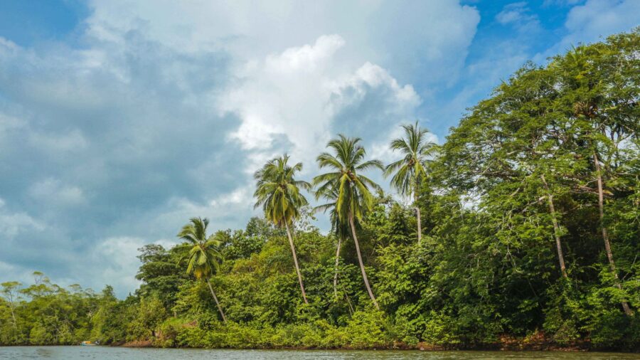
Floating the Buffalo is the classic way to take it all in. The water ranges from lively spring runs to slow summer drifts, and paddlers pass under bluffs, over gravel bars, and through long, quiet forest stretches without seeing another road. The lower sections near Rush are wide and calm, good for beginners or anyone who wants a relaxed few hours on the water. You can plan a half-day trip or stretch it into several days with overnight camping on the gravel bars. Shutterstock
Swim below the face of Painted Bluff
Buffalo Point is the most developed spot in the Lower District, and it draws people all summer for a reason. Its swimming hole sits directly below Painted Bluff, a tall, colorful cliff face that reflects in the water below. The pool runs deep and clear. A small picnic area sits above the river with a view up the valley. It makes a natural base for the area, close enough to Rush and the Indian Rockhouse Trail that you can cover both in one day without driving far. Shutterstock
A bluff shelter used by people thousands of years ago
The Indian Rockhouse Trail starts near Buffalo Point and leads to a massive prehistoric bluff shelter, a cave-like overhang carved out by centuries of erosion. People lived under that rock thousands of years ago. On the way in, the trail moves past rock formations, a small waterfall, and a seasonal stream that cuts through the hillside. The shelter itself is large enough to walk inside and stand up, and the size of it stops you. The sense of time that comes with it is harder to describe.
Read more from this brand:
No dams, no fees, no crowds: Arkansas’s Buffalo River runs wild through the Ozarks
You can walk 300 years of history at this Arkansas park and see nobody else
Elk at dawn, limestone bluffs, and a river that beat every dam ever proposed in Arkansas
The post This Arkansas valley holds rusted mines, stone ruins, and 100 miles of free river appeared first on When In Your State.
Shutterstock
Five hundred elk have come back to these hills
Arkansas’s only wild elk herd lives along the Buffalo River corridor and the surrounding Ozark country. Wildlife officials put the herd at roughly 450 to 500 animals spread across a wide range. Boxley Valley is one of the most reliable spots to watch them in open fields at dawn or dusk, and in fall, bulls bugling during the breeding season carry across the valley for a long way. The herd was brought back to the region in the 1980s. Deer, turkey, beaver and bald eagles fill out the rest of what you’re likely to see. Shutterstock
The Milky Way arches over the river valley
Buffalo National River is an International Dark Sky Park, the first in Arkansas, and the night sky here is one of the darkest in the southeastern United States. On clear nights, the Milky Way runs the full width of the sky above the river valley. Rangers run night sky programs at Buffalo Point and Tyler Bend in summer, and the park has rustic cabins and campgrounds that make it easy to stay long after sunset. It’s a different park after dark. Shutterstock
History, wilderness, and almost no crowds
Very few places hand you a preserved ghost town and a protected wild river in the same afternoon. Rush gives you a quiet look at a vanished industry without tour buses or gift shops, and the park around it delivers bluffs, waterfalls, elk and clear water without much development to get in the way. The whole area holds close to what it looked like generations ago. If you want history, nature and solitude in the same trip, this part of Arkansas delivers all three. Shutterstock
Explore Rush Historic District and Buffalo National River in Arkansas
You can reach Rush Historic District by taking an unpaved road off Arkansas Highway 14 near Yellville in Marion County. The National Park Service manages it as part of Buffalo National River. For trip planning, stop at the Tyler Bend Visitor Center or Buffalo Point Ranger Station, where rangers can fill you in on current river conditions, trail closures and elk-watching spots. River levels shift with rainfall, so paddlers should check conditions before launching. Admission to the park is free. This article was created with AI assistance and human editing. Read more from this brand:
No dams, no fees, no crowds: Arkansas’s Buffalo River runs wild through the Ozarks
You can walk 300 years of history at this Arkansas park and see nobody else
Elk at dawn, limestone bluffs, and a river that beat every dam ever proposed in Arkansas
The post This Arkansas valley holds rusted mines, stone ruins, and 100 miles of free river appeared first on When In Your State.
Leave a Reply