Climb Vermont’s Camel’s Hump and find nothing but rock, wind, and sky: Authorities confirm
Wikimedia Commons/Niranjan Arminius
A Peak With Two Distinct Humps
You know this shape even if you have never climbed it. Camel’s Hump rises with a double-hump silhouette that Vermonters would recognize from a mile away, and it even earned a spot on the state quarter. At 4,083 feet, it ties Mount Ellen as the third-highest point in Vermont, but it holds a title none of the taller peaks can claim. No road climbs it. No tower or building sits on top. When you reach the summit, you get rock, wind and open sky, nothing else, and that emptiness is exactly the point. Wikimedia Commons/Eric Marshall
One Man’s Gift Kept the Mountain Wild
Long before hikers showed up with trekking poles, Native peoples already had names for this peak. The mountain’s protected status traces back to 1911, when landowner Joseph Battell handed it over to the State of Vermont with one condition attached. He wanted the forest left in a primeval state, with no cutting of trees allowed. State law caught up with his wish in 1969, creating the Camel’s Hump Natural Area you hike through today. Walk the Alpine Trail and you will also pass wreckage from a B-24 bomber that crashed into the mountain in 1944, killing nine of its ten crew members. Pieces of the wing still rest near the summit. Wikimedia Commons/Famartin
Three States Open Up From the Top
Reach the bare summit and the view spins a full 360 degrees around you. Turn west and Lake Champlain stretches out below, with New York’s Adirondack Mountains rising behind it. Face east and New Hampshire’s White Mountains fill the horizon. Look north and south and you catch Vermont’s other giants, including Mount Mansfield and Killington, standing along the same ridgeline. On a clear day, some hikers claim they can spot land across the Canadian border. Few summits in New England hand you three states and a foreign country in one sweep. Wikimedia Commons/Famartin
A Slice of the Arctic Survived Here
About 10 acres of alpine tundra cover the summit, and these plants have no business growing this far south. They belong hundreds of miles north, near the Arctic, and they have clung to this mountain since the last Ice Age receded roughly 12,000 years ago. Only two other Vermont peaks carry alpine zones this significant: Mount Mansfield and Mount Abraham. The soil up here runs thin, and a single footstep off the marked rock can crush plants that took centuries to establish. Watch where you place your boots once the trees disappear behind you.
Wikimedia Commons/ImagePerson
Tiny Plants That Outlasted an Ice Age
Look closely at the summit rocks and you will find Bigelow’s sedge, alpine bilberry and mountain sandwort pressed low against the stone. Crowberry, mountain cranberry and Labrador tea grow beside them, all low and tough enough to survive brutal wind, cold and almost no soil. Many of these species rank as rare or very rare anywhere else in Vermont. Green Mountain Club stewards often stand near the summit during busy weekends, not to lecture you, but to point out which patches of ground need your boots to stay off them. Wikimedia Commons/Joe Calzarette
Take the Burrows Trail for a Straight Shot Up
If this is your first trip up Camel’s Hump, the Burrows Trail is where most people start. The round trip runs about 4.8 miles, and it climbs steadily through quiet birch, beech and maple forest without giving away much of a view along the way. That is deliberate. The trail saves its reward for the very end. Near the top, it meets the Long Trail at a spot called the Hut Clearing, just a short walk from the summit itself. You will not see much until you are almost there, and then you will see everything at once. Wikimedia Commons/Niranjan Arminius
The Monroe Trail Breaks Out Onto Bare Rock
Approach from the mountain’s eastern flank and you will take the Monroe Trail instead, a longer route at about 6.8 miles round trip. Much of the climb winds through leafy maple and birch forest, similar to the Burrows side, but the final stretch changes character fast. Bedrock and large boulders replace the dirt path, and you break above the treeline into sudden, wide views facing west. The Monroe Trail connects with the Long Trail for the last push, so you will likely cross paths with backpackers making their way through on a longer journey. Wikimedia Commons/Calebhsimone
You’re Walking a Piece of America’s Oldest Trail
The famous Long Trail runs 272 miles across Vermont, from the Massachusetts border to Canada, and it passes directly over the Camel’s Hump summit. This footpath holds the title of the oldest long-distance hiking trail in the country, predating even the Appalachian Trail. Backpackers tackling the full route often reach this mountain as one stop in a multi-day trek that spans the entire state. When you hit the summit on a day hike, do not be surprised to share the rocks with someone who has been walking for a week straight. That mix of casual hikers and long-haul backpackers gives the top a different kind of energy. Wikimedia Commons/John Nicholas LeCounte Anderson
The Final Stretch Turns Into a Scramble
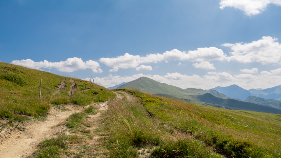
Trees start to shrink the higher you climb, thinning out until they disappear entirely near the top. The last push to the summit turns steep and rocky, with natural stone staircases and bare bedrock replacing any real trail. You will use your hands as much as your feet here, scrambling over rock in a way that feels more like climbing than hiking. Then, without much warning, the trees vanish completely and the world opens into rock, sky and wind.
Read more from this brand:
Five small towns, one road, and Lake Champlain on both sides: Vermont’s quietest drive
Five miles long, flanked by cliffs: Vermont’s most dramatic lake sits almost entirely alone
Lake Champlain’s oldest tap room is in Addison, Vermont, and yes, you can hurl spears here
The post Climb Vermont’s Camel’s Hump and find nothing but rock, wind, and sky appeared first on When In Your State.
That sudden shift from forest to open summit is part of what people remember most. Wikimedia Commons/Niranjan Arminius
A Mountain That Changes With Every Season
Summer fills the lower trails with wildflowers and thick green forest, while fall turns the whole mountain into color, with leaves crunching under your boots. Winter transforms the summit into a quiet, snow-covered world that draws snowshoers willing to brave the cold and wind. No matter which season you pick, the upper mountain keeps its wild, remote feel intact. Come back in a different month and you will notice the mountain shows you a completely different face, even though the trails and the summit stay exactly where you left them. Wikimedia Commons/Omarcheeseboro
Streams, Beaver Ponds and Moose Along the Way
The lower slopes of Camel’s Hump run thick with hardwood forest, and streams and beaver ponds break up the trail as you climb. Birds fill both the woods below and the open ridge above the treeline, so keep your ears open even before you reach the summit. Moose and deer roam the wider park, though spotting one takes some luck. Rushing brooks and smooth rocks scattered along several trails make for good rest stops, the kind of spot where you sit down for five minutes and end up staying for twenty. Wikimedia Commons/R Sharp
A Climb That Sticks With You Long After
Few mountains this size still feel this wild, and that bare, undeveloped summit is rare in a state where most high points get a road, a tower or a gift shop eventually. The double-humped shape has become a symbol Vermonters carry with real pride, printed on license plates and pointed out from car windows. Reaching the top after climbing through forest, scrambling over rock and breaking into open sky feels like something you earned, not something you drove to. Between the views, the rare plants clinging to the summit and the quiet forest on the way up, Camel’s Hump leaves an impression that outlasts the hike itself. Wikimedia Commons/Niranjan Arminius
Visiting Camels Hump State Park in Vermont
You will find Camel’s Hump straddling the towns of Huntington and Duxbury, roughly a 45-minute drive from Burlington near Waterbury. There is no entrance gate, visitor center or staffed office anywhere in the park, and you will not pay a fee to hike here. Instead, you park at one of several undeveloped trailhead lots, most commonly the Burrows Trail lot in Huntington or the Monroe Trail lot in Duxbury. Those lots fill fast on summer weekends, so arrive early or have a backup trail in mind. High-elevation trails close during spring mud season, typically from snowmelt through Memorial Day weekend. Pack layers and water even on warm days, since the exposed summit stays cold and windy, and stay on rock once you reach the alpine zone. This article was created with AI assistance and human editing. Read more from this brand:
Five small towns, one road, and Lake Champlain on both sides: Vermont’s quietest drive
Five miles long, flanked by cliffs: Vermont’s most dramatic lake sits almost entirely alone
Lake Champlain’s oldest tap room is in Addison, Vermont, and yes, you can hurl spears here
The post Climb Vermont’s Camel’s Hump and find nothing but rock, wind, and sky appeared first on When In Your State.
Leave a Reply