Denali’s steepest trail climbs 1,700 feet straight up to Alaska’s best view: Here’s the latest
Shutterstock
It’s a hard climb with an unforgettable payoff
Most people who come to Denali never leave the road. The park is mostly trailless wilderness, and for a lot of visitors, that means staying close to the entrance. But right there, a handful of maintained trails climb, loop, and wind through forest, canyon, and alpine ridge. The steepest of them punches straight up 1,700 feet to a rocky perch where, on a clear day, you can see the top of North America. Wikimedia Commons/Emily Mesner
A 1,700-foot climb in 2.7 miles
Mount Healy Overlook Trail does not ease you in. It runs 2.7 miles one way with 1,700 feet of elevation gain, and the National Park Service lists it as one of the steepest trails in Denali. You start near the Denali Visitor Center and climb the whole way out, then turn around and come back down the same route. There is no loop. What keeps people going is the promise of what waits at the top. Shutterstock
The forest takes you in before it lets you go
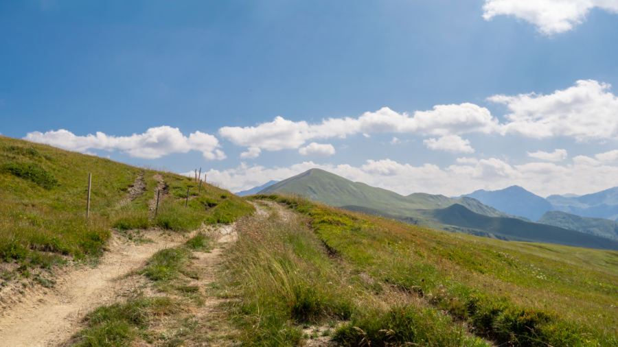
The lower section of the trail rises at a steady grade through spruce forest, shaded and quiet. Around the halfway point, a pair of benches gives you a reason to stop. Turn around and the valley is already dropping away behind you. Past those benches, the climb gets serious. Switchbacks push you above the treeline over a short distance, and suddenly the trees fall away and open alpine ground opens in every direction. The park asks hikers not to cut the switchbacks, since doing so tears up the slope. Wikimedia Commons/Dubhe
What the view looks like from the overlook
The maintained trail ends at a rocky, open perch. From there, you can see in nearly every direction. The Nenana River threads through the valley floor far below, and the mountains around you shift from brown to green to gray to blue depending on the light and the distance. On clear days, the top of Denali comes into view to the south. It is the kind of view where you stop talking and just look for a while. Shutterstock
Wildflowers and low plants take over above the trees
Through the summer months, wildflowers push up along both sides of the trail. Higher up, where the trees give out, the ground turns to grasses, moss, and low plants growing between the rocks. The rocky outcrop at the summit end faces out toward the broader park, with nothing blocking the sightlines in any direction.
The openness up there is part of what makes the climb worth the burn in your legs. Shutterstock
Dall sheep show up on the higher ridges
Wildlife does not announce itself. Fur caught on brush and tracks pressed into mud are often the first signs that something passed through. Arctic ground squirrels are common on the open slopes above the treeline, darting between rocks. Moose browse lower down in the wooded stretches. Higher up on the rocky ridges, Dall sheep sometimes appear as white shapes against the gray. Give them space, watch from where you stand, and let them move at their own pace. Shutterstock
The Taiga Trail ties the whole entrance cluster together
A short connector called the Taiga Trail links the visitor center to several nearby hikes, including Mount Healy Overlook, Horseshoe Lake, and Rock Creek trails. It runs through mixed spruce and aspen forest and works well as a warm-up before the steep climb or a way to wind down after. Signed junctions mark where each path splits off. If you are piecing together a full day from the entrance area, the Taiga Trail is the thread that connects all of it. Shutterstock
Horseshoe Lake sits still below the trees
Horseshoe Lake Trail is a two-mile round trip that drops steeply to a quiet lake ringed by forest. A short spur takes you to an overlook of a beaver dam. Beavers, moose, and waterfowl all turn up here if you arrive without rushing. At the north end of the trail, the path opens alongside the Nenana River. It is a complete contrast to the Healy climb, all flatness and water and stillness, and it fits well as either a warm-up or a way to end the day. Shutterstock
The Nenana River runs through taiga forest
The entrance-area trails all sit in boreal forest, also called taiga, along the Nenana River. White and black spruce form the backbone of the woods, with aspen, willow, birch, and berry shrubs filling in between the trunks. That mix of dense forest and open water draws moose and forest birds year-round. Below the Healy Overlook, you can see the river braiding through the valley floor, cutting wide, shallow channels through gravel and silt. Shutterstock
Savage River Canyon is an easy walk through rock walls
The Savage River Loop covers 1.7 miles with almost no elevation change. The trail travels along both sides of the river as it cuts through a rocky canyon, and a footbridge carries you across the water at the far end. Dall sheep sometimes show up on the slopes above the canyon walls.
Read more from this brand:
Why tens of thousands of people tried to cross these Alaska mountains on foot before the railroad came
Six Yellowstones fit inside this Alaska park but almost no one visits
Whales, puffins, and rivers of ice: Alaska’s Kenai Fjords charges zero to enter
The post Denali’s steepest trail climbs 1,700 feet straight up to Alaska’s best view appeared first on When In Your State.
Ground squirrels and, occasionally, caribou have also been spotted along the route. For anyone who wants to stay close to the ground and still feel deep inside the landscape, this is the one to start with. Shutterstock
Savage Alpine adds a ridge walk for those who want more
The Savage Alpine Trail climbs above the treeline onto Healy Ridge and runs about four miles point to point between two trailheads. The terrain shifts between open alpine ground and broad views down into the valleys on either side of the ridge. Wildflowers and wildlife sightings come regularly along the higher stretches. Pair it with the Savage River Loop for a longer day that covers both canyon and alpine ground without repeating any trail. Shutterstock
One trailhead cluster, a full day of terrain
Everything near the entrance connects. You can start the morning with the Horseshoe Lake loop, pick up the Taiga Trail connector, grind up the Healy Overlook, and still have time for the Savage River Canyon in the afternoon. Short connectors like Rock Creek and the Roadside Trail add more forest walking between the bigger routes. Together, the trails cover Denali’s three worlds in miniature: boreal forest, river canyon, and open alpine ridge. The whole park is out there beyond the entrance road. But you do not have to go that far to see what it’s made of. Shutterstock
Hit the Mount Healy Overlook Trail in Denali National Park
To reach the Mount Healy Overlook trailhead, start at the Denali Visitor Center and walk about half a mile in via the Horseshoe Lake or Taiga trails before hitting the Healy junction. The trailhead has no separate parking lot. Plan for 2.7 miles each way and a total elevation gain of 1,700 feet. Wear sturdy shoes, carry more water than you think you need, and bring a layer. The overlook sits in the wind almost every day. The maintained trail ends at the rocky perch; the ridge beyond it is unmarked and best left to experienced off-trail hikers. The park is open year-round, though most trails are most accessible from late May through early September. This article was created with AI assistance and human editing. Read more from this brand:
Why tens of thousands of people tried to cross these Alaska mountains on foot before the railroad came
Six Yellowstones fit inside this Alaska park but almost no one visits
Whales, puffins, and rivers of ice: Alaska’s Kenai Fjords charges zero to enter
The post Denali’s steepest trail climbs 1,700 feet straight up to Alaska’s best view appeared first on When In Your State.
Leave a Reply